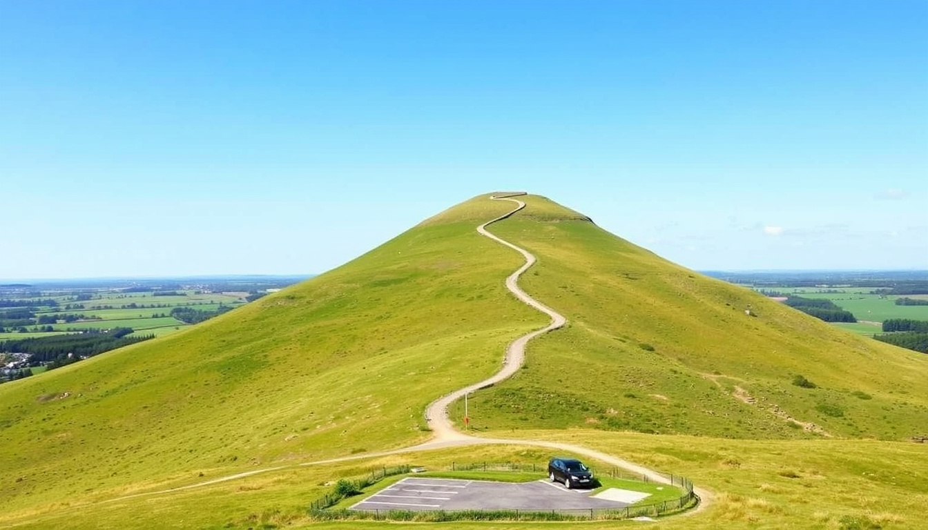
Roseberry Topping is one of North Yorkshire’s most recognisable landmarks. Its distinctive conical shape draws walkers, photographers, and families from across the region. The hill is owned and managed by the National Trust, and the summit rewards visitors with panoramic views over the North York Moors and Cleveland.
The walk is short but rewarding, with a mix of woodland paths and open hillside. Most visitors start from the Newton-under-Roseberry car park, where a well-maintained route leads to the top in about an hour. The hill stands at 320 metres (1,049 feet) and offers a moderate challenge suitable for most fitness levels.
Planning a trip requires a few practical details: where to park, what the walk involves, and what to expect in terms of facilities. This guide brings together verified information from official sources and experienced walkers.
How do I walk up Roseberry Topping?
- Height: 320 m (1,049 ft)
- Walk distance: approx. 2.5 miles (4 km) round trip for the classic route
- Walk time: 1–2 hours depending on pace and stops
- Parking: Pay-and-display car park at Newton-under-Roseberry (postcode TS9 6QR)
- Roseberry Topping is a popular landmark in North Yorkshire, owned by the National Trust.
- The summit offers panoramic views of the North York Moors and Cleveland.
- The walk is moderate but can be steep in sections; sturdy footwear recommended.
- Parking is limited and fills quickly on weekends and sunny days – arrive early.
- The nearest pub is The Royal Oak in Newton under Roseberry (approx. 1 mile).
| Attribute | Value |
|---|---|
| Location | Great Ayton, North Yorkshire, England |
| Height | 320 m (1,049 ft) |
| Owner | National Trust |
| OS Grid Reference | NZ 570 126 |
| Postcode for car park | TS9 6QR (most common; also listed as TS9 6QS) |
| Nearest pub | The Royal Oak, Newton under Roseberry |
| Distance from Middlesbrough | 12 km (7.5 miles) |
What is the walking distance and time?
The classic short walk from the Newton-under-Roseberry car park is roughly 2.4–2.5 miles round trip. Most walkers complete it in 1–1.5 hours. A longer circular route from Great Ayton or Gribdale Gate can extend to around 7 km (4.3 miles) and take about 2 hours, according to several route guides.
What is the best route to the summit?
From the main car park, the recommended route follows Roseberry Lane into Newton Wood, then takes a stepped path before joining the steep stone path to the summit. This is the most direct and well-signposted route, as described by the National Trust and Visit Tees Valley.
How steep is the climb?
The final section is steep and includes stone steps. The lower woodland path is gentler. Overall, the climb is considered moderate. Most walkers with a reasonable level of fitness manage it without difficulty, though sturdy footwear is advised.
What is the height of Roseberry Topping?
Multiple sources, including the Ordnance Survey and National Trust, confirm the height as 320 metres (1,049 feet). This makes it a relatively modest hill, but its exposed summit provides exceptional views across the surrounding countryside.
Where can I park at Roseberry Topping?
Are there dedicated car parks?
The main car park is a public pay-and-display facility at Newton-under-Roseberry, located on the A173. It is managed by the National Trust and is the most convenient starting point for the classic walk. Alternative parking is available at Gribdale Gate, also known as Captain Cook’s car park, and along Hutton Village Road, though these options are route-dependent and may add walking distance.
The Newton-under-Roseberry car park has space for roughly 50 vehicles. It fills quickly on weekends, bank holidays, and sunny days. Arriving before 9 a.m. increases your chances of securing a spot.
What is the postcode for the car park?
The most frequently cited sat-nav postcode for the main car park is TS9 6QR. Some route guides list TS9 6QS, and the Gribdale Gate car park is given as TS9 6HN. If using a GPS, entering “Newton-under-Roseberry” as the destination may be more reliable.
Is parking free?
The Newton-under-Roseberry car park is pay-and-display, not free. Charges apply, and the exact fee can vary. The Gribdale Gate car park is sometimes described as free, but this is not always clearly signposted and may involve a longer walk.
How busy does parking get?
Parking at the main car park is limited, and congestion is a known issue. TripAdvisor reviews and local guides consistently note that the lot overflows on sunny weekends. The National Trust does not provide real-time capacity updates, so early arrival is strongly recommended.
What facilities are near Roseberry Topping?
Which pubs are closest to Roseberry Topping?
The Royal Oak in Newton under Roseberry is about 1 mile from the main car park and is a popular stop for walkers. The King’s Head Inn, located on the A173 near an additional pay-and-display car park roughly 300 yards north of the main lot, is another option. Both serve food and drinks, though seasonal opening hours should be checked directly.
Are there any cafes or shops nearby?
There are no cafes or shops directly at the car park or along the walking route. The nearest facilities are in Great Ayton, about 2 miles away, where you can find cafes, a village shop, and a bakery. Toilets are available at the base car park, according to visitor reports.
The King’s Head Inn is also a landmark for an additional pay-and-display car park. This is about 300 yards north of the main Newton-under-Roseberry car park, according to a route guide on Hiking Photographer.
What is the weather forecast for Roseberry Topping?
When is the best time of year to visit?
Spring and autumn offer the most comfortable walking conditions, with milder temperatures and fewer crowds. Summer can be busy, and winter walks require extra caution due to shorter daylight hours and potentially icy paths.
How does weather affect the walk?
The summit of Roseberry Topping is exposed, meaning conditions can be significantly windier and colder than at the base. Rain can make the stone steps slippery, and mist can reduce visibility. No official closure information is provided in real time, so walkers should assess conditions before setting out.
Where can I get a reliable forecast?
The Met Office provides a local forecast for Great Ayton, which is the nearest weather station. The National Trust does not publish a dedicated weather page for the hill. Checking the forecast on the morning of your walk is advisable.
Real-time weather conditions are not always accurately forecast. The summit is exposed, so carry extra layers even on mild days. Path conditions after rain can be muddy – suitable footwear is essential.
What is the history of Roseberry Topping?
- 20th century: The hill was used for mining ironstone and jet, and later became a popular viewpoint.
- 2000s: The National Trust took over management of the site and began improving footpaths.
- 2023: Path resurfacing and drainage work were carried out in the wooded section, as reported on the National Trust’s Facebook page.
- 2025: Current opening times and visitor information are maintained by the National Trust, with no major changes reported.
What information is certain and what is uncertain about visiting Roseberry Topping?
| Established information | Information that remains unclear |
|---|---|
| Height is 320 m (1,049 ft) – confirmed by Ordnance Survey and National Trust. | Postcode varies by source – TS9 6QR is most common, but TS9 6QS and TS9 6NA are also given. GPS coordinates are more reliable. |
| The hill is open to the public daily; no admission fee. | Real-time weather conditions are not always accurately forecast; check Met Office. |
| The main walking route starts from the National Trust car park at Newton under Roseberry. | Path conditions after rain can be muddy; no official closure information is provided in real time. |
| Parking is limited to approximately 50 spaces. | The pub (The Royal Oak) may have seasonal opening hours – verify directly. |
Why is Roseberry Topping significant?
Roseberry Topping is an iconic conical hill shaped by ancient geology and mining history. Its distinctive profile makes it a landmark for walkers and photographers. Compared to similar hills in the North York Moors, it offers a relatively short but rewarding climb with excellent views. The National Trust manages the site to balance conservation with visitor access. Recent path improvements indicate ongoing maintenance, but parking remains a persistent issue due to popularity.
What do official sources say about Roseberry Topping?
“At 1,049 feet, the summit offers fine views across North Yorkshire and Cleveland.”
— National Trust
“Roseberry Topping is a distinctive hill in North Yorkshire, England.”
— Wikipedia
“Great climb, stunning panoramic views. Gets very busy on sunny days… Inadequate parking facilities.”
— TripAdvisor review
What should I know before visiting Roseberry Topping?
Check the National Trust website for any planned path closures or events. Sign up for local weather alerts before visiting. Consider visiting on weekdays or early mornings to avoid crowds. For more ideas on exploring the region, see our Poems Funeral – Uplifting, Short, Modern & Funny Options guide.
Frequently asked questions
What is the postcode for Roseberry Topping?
The approximate postcode for the main car park is TS9 6QR. Use “Newton under Roseberry” for sat-nav.
Is there a pub near Roseberry Topping?
Yes – The Royal Oak in Newton under Roseberry is the closest (about 1 mile from the car park). The Kings Head in Great Ayton is another option.
How difficult is the walk up Roseberry Topping?
Moderate – there are some steep sections and steps. Most walkers complete it in 1.5–2 hours. Suitable for children with walking experience.
Can I take a map with me?
Ordnance Survey Explorer Map OL26 (North York Moors) covers the area. Digital maps are available on the National Trust website or walking apps.
Is Roseberry Topping suitable for dogs?
Yes, dogs are welcome but must be kept under control, especially near livestock.

Oliver Reeves leads fact-checking, source verification and editorial standards at RegionalReport.co.uk.