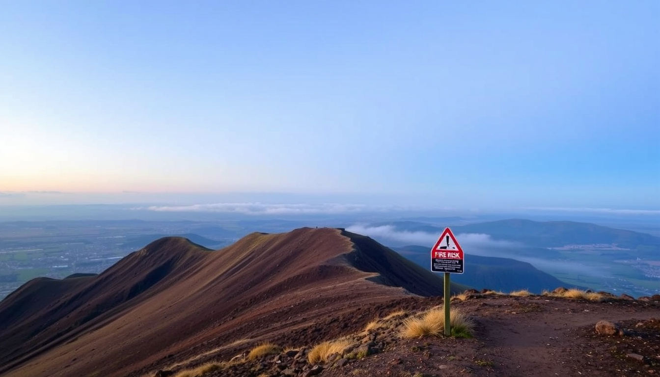
Arthur’s Seat rises 251 metres above Edinburgh’s Holyrood Park, the tallest of the park’s hills and the remnant of an extinct volcano. The summit attracts walkers and photographers with broad views over the city, the Firth of Forth and the surrounding hills.
The hill sits beside the Palace of Holyroodhouse and the Scottish Parliament at the eastern end of the Royal Mile. Although the city wraps around it, the park keeps a rural character, with grassland, gorse, lochs and basalt cliffs surrounding the peak.
A grass fire in July 2026 briefly closed parts of the park and drew fresh attention to the hill’s fire risk. The blaze was later described as extinguished and the park reopened, but access can change quickly and the latest official notices are worth checking before a visit.
Is Arthur’s Seat Open After the Fire?
A grass fire was reported at Arthur’s Seat at about , with the Scottish Fire and Rescue Service deploying six appliances and specialist equipment, according to APPI News. Queen’s Drive was closed while crews worked, and police advised people to avoid the area. Later visitor-guide updates describe the fire as extinguished and Holyrood Park reopened.
The fire affected vegetation rather than buildings, and no injuries were reported in the available coverage. The incident followed earlier wildfire concerns elsewhere in Scotland and underlined how quickly dry grass on the hill can ignite. Because conditions can change, official notices remain the best guide to current access.
Dry grass, wind, steep terrain and limited access for firefighting vehicles make hill fires difficult to control. Visitors are urged not to light fires or barbecues, not to discard cigarettes, and to report any sign of smoke to the emergency services immediately. In an emergency, call 999 and stay away from smoke, fire-service operations, cordons and unstable slopes, as recommended by Edinburgh Tourism.
Arthur’s Seat at a Glance
| What | A 251 m hill in Holyrood Park, Edinburgh, formed from an extinct volcano. |
|---|---|
| Where | Holyrood Park, near the Palace of Holyroodhouse, Edinburgh. |
| Why visit | Panoramic 360-degree views and a famous city walk. |
| Current status | Check official fire and access updates before visiting. |
Key insights
- Arthur’s Seat is the highest of the Holyrood Park hills, part of an extinct volcanic landscape rather than a separate mountain.
- The identity of “Arthur” in the name is unconfirmed; the link to King Arthur remains a theory.
- The volcano last erupted more than 350 million years ago.
- Fire and access status can change quickly, so official notices should be checked before travelling.
- Practical walking information, geological background and current safety status are all relevant when planning a visit.
- The summit is one of the most open and accessible viewpoints in Edinburgh.
Snapshot facts
| Fact | Detail |
|---|---|
| Location | Holyrood Park, Edinburgh, Scotland |
| Type | Hill / extinct volcanic peak |
| Elevation | 251 m (823 ft) |
| Highest peak in | Holyrood Park |
| Volcanic history | Part of an extinct volcano; lava samples dated to approximately 341–335 million years ago |
| Main nearby landmark | Palace of Holyroodhouse |
| Part of | The Arthur’s Seat volcanic area, which also includes Calton Hill and Castle Rock |
Why Is It Called Arthur’s Seat, Edinburgh?
The origin of the name is uncertain. One theory connects it with legends of King Arthur, including traditions associated with the early Welsh poem Y Gododdin. Another proposal derives it from a Gaelic phrase commonly interpreted as “height of the arrows.” A further theory treats the name as a corruption of “Archer’s Seat,” possibly linked to archery or military activity on the hill. The main alternative explanations appear in Expedia’s guide to the landmark.
Who Is Arthur in Arthur’s Seat?
Nobody knows for certain. The direct connection to King Arthur is not historically confirmed, and the early Welsh poem Y Gododdin does not settle the question. The name may echo Arthurian legend, a Gaelic description or an older military term, but none of these explanations is proven.
What Was the Hill Called in Earlier Records?
Charters of Holyrood Abbey recorded the hill as “Craggenmarf,” sometimes shortened to “the Crag.” The English name “Arthur’s Seat” is documented by the sixteenth century.
All proposed explanations for “Arthur’s Seat” are theories. None has been confirmed by historical or linguistic evidence, and the identity of “Arthur” remains an open question.
What Is Arthur’s Seat in Edinburgh?
Arthur’s Seat is the centrepiece of Holyrood Park, a roughly 650-acre open landscape in central Edinburgh, according to Wikipedia’s overview of the park. Holyrood Park lies beside the Palace of Holyroodhouse and the Scottish Parliament at the eastern end of the Royal Mile. Lochs, basalt cliffs, ridges, grassland and gorse give the park a rural appearance despite its location next to the historic centre.
Where Exactly Is Arthur’s Seat?
The summit is the highest point in Holyrood Park, reaching 251 metres above sea level. Its distinctive profile has been compared with a reclining lion: the two uneven summit areas are described as resembling a lion’s head and haunches. From many points in the city centre, the shape of the hill is instantly recognisable.
The view from the top takes in much of Edinburgh, including the Old Town, Edinburgh Castle, the Scottish Parliament, the Palace of Holyroodhouse and the Firth of Forth. Discovering Britain lists the summit among the city’s most prominent viewpoints.
What Else Is in Holyrood Park?
The park also contains Salisbury Crags, Dunsapie Loch, St Margaret’s Loch and a network of paths that connect them. These routes allow walkers to extend a climb to the summit into a longer circuit around the hill.
What Is the History of Arthur’s Seat?
Arthur’s Seat is the largest feature within the Arthur’s Seat volcanic area, which also includes Calton Hill and Castle Rock. The rocks date from the early Carboniferous period, with lava samples dated to approximately 341–335 million years ago, as noted in Wikipedia’s article on Arthur’s Seat.
How Was the Landscape Formed?
Several geological processes shaped the present landscape:
- Volcanic eruptions produced lava, basalt and volcanic debris.
- The former volcanic structure was later buried beneath younger rocks.
- Glaciers moving generally from west to east eroded the landscape and exposed the harder volcanic rocks.
- This erosion helped create the steep western crags and the gentler eastern slopes.
What Geological Features Can Still Be Seen?
The Geology of Arthur’s Seat resource published by the British Geological Survey identifies volcanic agglomerate near the base of the hill. Agglomerate consists of volcanic fragments embedded in a finer matrix and represents material that accumulated around the ancient vent.
Salisbury Crags were formed by a horizontal dolerite intrusion known as the Salisbury Crag Sill, which formed after the principal lava flows and vent activity. Hutton’s Section, a historically important geological exposure on the front of Salisbury Crags, is currently inaccessible because of slope instability; the area is cordoned off.
What Traces of Human History Remain on the Hill?
The hill contains the remains of an Iron Age fort, generally dated to around 2,000 years ago. The ruins of St Anthony’s Chapel, a fifteenth-century medieval structure, stand near the slopes above St Margaret’s Loch, as reported by CNN.
Hutton’s Section and parts of the Salisbury Crags frontage remain inaccessible because of slope instability and cordons. The Low Road to Duddingston has reportedly been closed to vehicles since March 2026 because of potential rockfall from Samson’s Ribs.
What Is the Arthur’s Seat Walk Like?
Several routes reach the summit, from a direct eastern climb to a longer circuit around Holyrood Park. The Arthur’s Seat Walk Guide outlines the main approaches in detail.
Which Route Should You Take to the Summit?
The most direct ascent starts near Dunsapie Loch on the eastern side of the park. This eastern route is generally the easiest way up, and the summit can be reached in roughly 30–40 minutes each way, depending on pace and conditions. The path crosses open grassland before becoming steeper and rockier near the top.
A popular alternative begins near St Margaret’s Loch or the Palace of Holyroodhouse, following the path towards Haggis Knowe and then continuing up the ridge to the summit. Nomado Travel’s guide describes this route as more scenic and commonly used by visitors, while warning that wet rock can be slippery.
A longer circuit walks around the hill through Holyrood Park, combining Arthur’s Seat, Salisbury Crags, Dunsapie Loch and St Anthony’s Chapel. This option takes substantially more time; the length and duration vary with diversions, weather and path conditions.
What Should You Know Before Starting the Climb?
The climb is short but not completely effortless. Exposed sections of the summit can be windy, and the rock is uneven and polished smooth in places, becoming particularly hazardous when wet. Footwear with good grip is important, along with water and extra time in poor visibility.
Dogs should be kept under control around livestock, wildlife, steep edges and other walkers. Mobile-phone navigation should not be relied on alone in fog or darkness.
The eastern approach from Dunsapie Loch is generally the easiest ascent and can be completed in about 30–40 minutes each way. It is a good choice for walkers who want the most straightforward climb to the summit.
When Did the Recent Arthur’s Seat Fire Happen?
Arthur’s Seat has been shaped by volcanic activity, glaciation, human settlement and, most recently, wildfire. Key moments include:
- More than 350 million years ago: volcanic activity forms the rock that becomes Arthur’s Seat.
- Around 2,000 years ago: an Iron Age fort is built on the hill.
- Fifteenth century: St Anthony’s Chapel is constructed on the slopes above St Margaret’s Loch.
- Sixteenth century: the English name “Arthur’s Seat” is documented.
- March 2026: the Low Road to Duddingston is reportedly closed to vehicles because of potential rockfall from Samson’s Ribs.
- July 19, 2026, 6:38 p.m.: a grass fire is reported at Arthur’s Seat; six appliances and specialist equipment are deployed, according to APPI News.
- July 19, 2026, evening: Queen’s Drive is closed and police advise people to avoid the area because of smoke.
- Shortly afterwards: the fire is extinguished and Holyrood Park is subsequently described as reopened by the Arthur’s Seat Walk Guide.
What Is Known About Arthur’s Seat and What Is Still Uncertain?
Some facts about the hill are well established, while other questions remain open.
| Established information | Information that remains unclear |
|---|---|
| Arthur’s Seat is located in Holyrood Park, Edinburgh. | The exact origin of the name “Arthur’s Seat”. |
| It is the main peak in the park. | Whether the “Arthur” in the name is King Arthur. |
| It is part of an extinct volcano that last erupted more than 350 million years ago, and it is a popular walking and lookout spot. | Current access status after fire incidents, which can change quickly. |
How Does Arthur’s Seat Fit Into Edinburgh’s Landscape?
Arthur’s Seat forms the centrepiece of Holyrood Park, a roughly 650-acre open landscape that runs from the edge of the Old Town towards Duddingston. Lochs, basalt cliffs, ridges, grassland and gorse give the park a rural character that is rare so close to a city centre.
The hill belongs to the Arthur’s Seat volcanic area, which also includes Calton Hill and Castle Rock. These three rocky heights give central Edinburgh its distinctive skyline. Holyrood Park developed as royal parkland around Holyrood Abbey and the Palace of Holyroodhouse, which explains why so much open land survives beside the historic centre.
Where Can You Find Reliable Updates and Visitor Information?
The most reliable access information for Arthur’s Seat comes from Historic Environment Scotland, which manages Holyrood Park. Its notices cover path closures, cordons and management decisions that affect access to the hill.
For fire incidents and emergency warnings, the Scottish Fire and Rescue Service publishes official alerts, while the City of Edinburgh Council provides local updates on parks and public safety. VisitScotland offers a visitor-facing overview of the hike for those planning a first climb. Because conditions can change quickly after fire, heavy rain, high winds or rockfall, checking these channels shortly before setting out is the surest way to confirm that the hill is open.
What Should Visitors Remember Before Visiting Arthur’s Seat?
Arthur’s Seat offers one of the quickest routes from central Edinburgh to open hill country: a 251-metre extinct volcano with broad views over the city, the Firth of Forth and the surrounding hills. The eastern route from Dunsapie Loch provides the easiest climb, the summit views are the main reward, and the geology beneath the path is as interesting as the skyline above it. Confirm that the park is open before setting out, and treat fire safety seriously in dry conditions.
What Else Do Visitors Commonly Ask About Arthur’s Seat?
What can you see from Arthur’s Seat Lookout?
On a clear day, the lookout offers wide views over Edinburgh, including the Old Town, Edinburgh Castle, the Scottish Parliament, the Palace of Holyroodhouse and the Firth of Forth. It is one of the most popular viewpoint experiences in the city.
What is King Arthur’s Seat?
King Arthur’s Seat is another name used for Arthur’s Seat in Edinburgh. The direct connection to King Arthur is not historically confirmed.
How long does it take to walk up Arthur’s Seat?
The eastern route from Dunsapie Loch is generally the easiest and takes roughly 30–40 minutes each way, depending on pace and conditions.
Is Arthur’s Seat safe after the fire?
Available reports say the July 2026 grass fire was extinguished and Holyrood Park reopened. Access restrictions can change quickly, so check official notices before visiting.
Are dogs allowed on Arthur’s Seat?
Dogs are permitted but should be kept under control around livestock, wildlife, steep edges and other walkers.
Is Arthur’s Seat an extinct volcano?
Yes. Arthur’s Seat is part of an extinct volcano that last erupted more than 350 million years ago, during the early Carboniferous period.

Jack Sutton is Senior Reporter at RegionalReport.co.uk, covering breaking regional news, councils, transport, business and community stories across the UK.