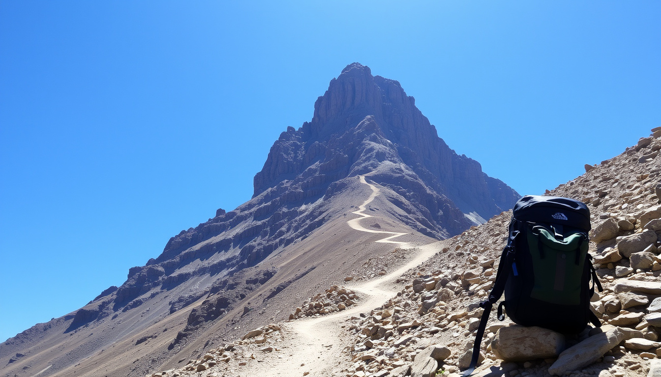
Mount Toubkal—also called Jebel Toubkal—is Morocco’s highest mountain and North Africa’s highest summit, reaching 4,167 m (13,671 ft). The normal summer route is a demanding, non-technical high-altitude trek; winter turns it into a serious snow-and-ice mountaineering ascent.
The mountain rises above the High Atlas, roughly 63 km south of Marrakech, with the village of Imlil at about 1,740 m serving as the normal starting point. Each year trekkers use the same two-day template: a long walk up the Mizane Valley, a night at the Toubkal Refuge, an early summit push, and a long descent back to Imlil.
Some of the key numbers are settled: the height, the distance, the two-day structure. Others—such as difficulty, cost, and conditions—depend on the season, the group, and choices made along the way.
How High Is Mount Toubkal and Where Is It Located?
Toubkal’s summit stands at 4,167 m (13,671 ft), a figure that appears consistently across mountaineering databases and trekking operators. That makes it the highest point in Morocco, the Atlas Mountains, and North Africa.
- Height: 4,167 m (13,671 ft)
- Location: High Atlas, 63 km from Marrakech
- Difficulty: Moderate (non-technical)
- Typical Duration: 2 days
Key insights for anyone planning the climb:
- Toubkal is the highest peak in North Africa, and altitude is the central draw for most climbers.
- The climb is a strenuous hike rather than technical climbing, but altitude and weather make preparation essential.
- Most trekkers start in Imlil and summit via the Toubkal Refuge over two days.
- Costs range from under €50 for an independent climb to roughly €300 for a guided two-day package.
- Late spring and early autumn generally offer the best balance of stable weather and manageable snow.
| Fact | Detail |
|---|---|
| Elevation | 4,167 m (13,671 ft) |
| First ascent | 1923 (Villers, Berger, Nussbaum) |
| Mountain range | Atlas Mountains |
| Country | Morocco |
| Alternative name | Jebel Toubkal |
| Prominence | 3,756 m (ranked 4th in Africa) |
| Normal starting point | Imlil, approx. 1,740 m |
| Typical climb duration | 2 days (Imlil to summit and back) |
| Round-trip distance | Roughly 26–27 km |
| Total ascent | Approximately 2,400–2,700 m |
| Technical level | Non-technical from late spring through autumn |
How Difficult Is Climbing Mount Toubkal?
Mount Toubkal is best described as moderate to strenuous, rather than an easy hike. The route is non-technical in normal summer conditions, but it involves major elevation gain, thin air, long walking days, steep terrain, and a demanding summit day.
A fit hiker with experience on long mountain trails can usually complete the normal route without prior mountaineering experience. The challenge builds over time: altitude slows most people down, and the descent on loose scree tests the legs long after the summit has been reached.
The Standard Two-Day Route
The classic approach leaves Imlil and follows the Mizane Valley, passing through or near the settlement and shrine of Sidi Chamharouch before continuing toward the Toubkal Refuge.
Day 1 covers about 10–13 km with roughly 1,400–1,500 m of ascent, taking around 5–7 hours. Most groups spend the night at a refuge at approximately 3,200 m. Mules commonly carry luggage on the lower approach, though they generally do not carry trekkers all the way to the summit route.
Most groups leave around 4 a.m. to reach the summit near sunrise. The route climbs the South Cirque (also called South Cwm) on steep scree, rocky slopes, and—depending on season—snowfields, gaining roughly 1,000 m to the summit ridge before the final pyramid and its metal summit marker. The refuge-to-summit section takes about 3–5 hours; the full return to Imlil often takes 6–9 hours.
The final ascent is not technically difficult in dry conditions, but the steep scree can be unstable and makes the descent particularly hard on the knees.
Can Beginners Succeed with Proper Preparation?
Beginners can climb Toubkal, provided they arrive with solid fitness and realistic expectations. Training should focus on long uphill walks, sustained stair or hill workouts, descending on uneven terrain, carrying a daypack, and consecutive days of hiking. Walking at a slow, steady pace matters more than speed.
Anyone preparing for a longer expedition may find a Base Camp Everest trek guide useful for comparison, since many of the same principles—gradual ascent, strong legs, layered clothing, and respect for altitude—apply on Toubkal at a smaller scale.
Guides, Mules, and Local Logistics
A guide is not legally required on the normal route, but most operators and experienced trekkers recommend one for safety, navigation, and organisation. Guides know the current snow conditions, can adjust plans when weather turns, and are part of the local mountain economy that depends on trekking. Mules are widely used on the lower section to carry luggage, although they generally do not carry trekkers all the way to the summit route.
The need for a guide becomes more pressing in winter, when snow and ice change the character of the ascent and route-finding becomes harder.
Basic Gear and Equipment
The gear list for a summer climb is shorter than a winter one, but still requires careful packing. At the summit, temperatures can be below freezing before sunrise even in summer, so warm layers and gloves stay in the pack all year.
- Footwear and clothing: broken-in hiking boots with ankle support, a warm insulating layer, a waterproof and windproof jacket, hiking trousers, spare base layers, hat, gloves, and warm socks
- Sun and navigation: sunglasses or glacier glasses, high-protection sunscreen, lip balm, a headlamp with spare batteries, and an offline map or GPS track
- Hydration and energy: water bottles or a hydration system, and high-energy snacks
- Health and hygiene: a personal first-aid kit, blister treatment, toilet paper, and hand sanitizer
- Overnight and logistics: a sleeping bag suitable for cold refuge nights, a daypack of 25–35 litres, trekking poles, and cash for local expenses
Altitude and Acclimatisation
Altitude is a significant factor. Spending a night at the refuge helps, but it does not eliminate the risk of acute mountain sickness. Symptoms such as severe headache, vomiting, confusion, loss of coordination, or worsening breathlessness require immediate descent.
Acute mountain sickness can affect any trekker above roughly 3,000 m, regardless of age or fitness. Severe headache, vomiting, confusion, loss of coordination, or worsening breathlessness require immediate descent. The refuge night reduces but does not remove the risk.
What Is the Weather Like on Mount Toubkal and When Is the Best Time to Climb?
Toubkal’s weather varies strongly with season. The mountain is climbable year-round, but the character of the ascent changes completely between summer and winter.
Spring (April to May)
Spring is one of the best periods for the climb. Weather is often relatively stable and temperatures are milder, but snow can remain on the upper mountain. Depending on conditions, crampons and an ice axe may be necessary.
Summer (June to August)
Summer generally brings dry trails and little or no snow on the standard route. Lower valleys can become very hot, while the summit and refuge remain cold, especially before dawn. The route is usually busiest in summer, and refuge space and guides can be in higher demand.
Autumn (September to October)
Autumn is widely regarded as an excellent trekking period because temperatures are comfortable, weather is often stable, and crowds usually decrease after the summer peak.
Winter (November to March or April)
Winter conditions are substantially more serious. Snow and ice commonly cover the upper route, temperatures at the refuge can fall well below freezing, and the ascent requires snow-travel skills. Some sources describe late November through April as a genuine winter mountaineering trip rather than an ordinary trek.
Typical winter requirements include:
- Crampons
- Mountaineering ice axe
- Appropriate winter boots
- Avalanche and route-awareness skills
- An experienced mountain guide
Best Overall Periods
For most hikers, the best periods are late April to May, when conditions are cooler and spring snow may still require technical equipment, and September to October, which often offers the best balance of stable weather, moderate temperatures, and fewer crowds. June to August works for those who want a dry, straightforward route but can tolerate heat in the valleys and larger numbers of trekkers.
The most straightforward non-technical conditions are generally found during the dry season, but exact snow conditions vary substantially from year to year. A local guide should confirm whether crampons or an ice axe are needed before departure.
Snow cover varies from year to year and from week to week. A local guide can confirm whether crampons or an ice axe are needed shortly before departure, and reliable weather forecasts on the mountain generally cover only a few days ahead.
How Much Does It Cost to Climb Mount Toubkal?
Costs vary with group size, season, guide arrangements, transport, accommodation, and whether equipment rental is included. There is no single fixed price for the hike, but most budgets fall into two broad categories.
Guided Group Tours: €150 to €300
A two-day guided package typically costs between €150 and €300. These packages usually include transport, accommodation, meals, a guide, and sometimes mules or equipment. Booking through an agency abroad often costs more than arranging the same services locally in Imlil.
Climbing Independently: Roughly €30 to €50
Trekkers who organise everything themselves—permits, refuge stay, and shared transport—can keep the core cost to around €30–€50. This lower figure assumes no guide, no mules, and no equipment rental, and it can rise quickly once those extras are added.
Additional Costs to Budget For
- Guide fee: roughly €50–€100 per day
- Mule hire for luggage on the lower approach
- Equipment rental (crampons, ice axe, winter boots)
- Transfer from Marrakech to Imlil and back
- Accommodation in Imlil before or after the trek
A shared grand taxi from Marrakech to Imlil costs roughly €20–€30 per person and takes about 1.5–2 hours. Pre-booked private transfers are more expensive. Accommodation in Imlil and meals at the refuge add to the total, and prices can shift with season and exchange rates.
Why Prices Fluctuate
Prices vary by season and agency; booking in advance is often cheaper than arranging at the last minute. Summer and holiday periods push demand up, while autumn and late spring tend to be more flexible. Equipment rental costs depend on whether you buy in Marrakech or carry your own gear.
A locally booked, two-day guided trip from Imlil generally costs less than a package sold abroad. The final price depends on group size, season, transport, and exactly which services are included.
What Is the History of Climbing Mount Toubkal?
Toubkal’s recorded climbing history is short compared with the Alps or the Himalayas, but it shows a clear pattern of growth in visitor numbers and infrastructure.
- 1923: First recorded ascent by a European party made up of M. Villers, M. Berger, and H. Nussbaum.
- 1930s: The Toubkal Refuge (now Refuge du Toubkal) is built to accommodate mountain visitors.
- 1990s: Trekking tourism increases and the approach trails from Imlil are improved.
- 2020–2025: Toubkal grows in popularity as a non-technical high-altitude trek; more guided tours and online planning resources appear.
- 2025: Trail maintenance and weather monitoring continue; changing snow cover becomes a point of attention for local guides.
What Is Certain About Toubkal and What Remains Uncertain?
Some facts about Toubkal are firmly established, while others depend on conditions, judgement, or change over time.
| Established information | Information that remains unclear |
|---|---|
| Elevation: 4,167 m (officially surveyed) | Difficulty rating is subjective and varies with fitness and weather |
| Location: High Atlas, Morocco | Weather forecasts are reliable only a few days ahead |
| First ascent year: 1923 | Exact cost varies by season, guide quality, and exchange rates |
| No technical climbing required on the standard route | Future trail conditions may shift with climate change |
The mountain’s prominence—3,756 m, ranked fourth in Africa—is also well documented in mountaineering databases. What those databases cannot predict is how a given week of weather, snow cover, or fatigue will affect an individual trekker.
What Does “Jebel Toubkal” Mean and How Do You Say It?
“Jbel” or “Jebel” means mountain in Arabic, so Jebel Toubkal is simply “Mount Toubkal.” English speakers commonly pronounce the summit name as “TOOB-kahl” or “TOOB-kal,” with two syllables. Locally, the name is rendered with the same “toob-kal” sound, preceded by “jeb-el.”
Toubkal is one of the world’s most accessible high-altitude treks, despite its elevation. That accessibility shapes the mountain’s role in Morocco’s adventure tourism: the summit is a symbol of the High Atlas and a reliable draw for visitors based in Marrakech, roughly 63 km away.
The trekking economy around Imlil depends on local guides, muleteers, and refuge staff. Hiring them is part of what makes the route viable, and it channels tourist spending into the mountain communities. BBC Travel has run a feature on why Morocco’s Mount Toubkal is a hiker’s dream, focusing on the same combination of scale and convenience.
Which Sources Provide Reliable Information About Toubkal?
For hikers who want to verify facts before a trip, several independent sources converge on the same core figures. The Moroccan National Tourist Office is the official reference for travel in Morocco. The climbing community maintains route notes and photographs on SummitPost, and Wikipedia’s article on Jebel Toubkal summarises the mountain’s geography and history. Mountaineering databases such as Peakbagger track elevation and prominence data.
“Mount Toubkal stands at 4,167 meters, making it the highest peak in North Africa and one of the most popular trekking destinations in Morocco.”
— mount-toubkal.com
“At 4,167 m, Mount Toubkal is the highest peak in North Africa. It can be climbed in two days via Imlil and the refuge.”
— explore.co.uk blog
“Mount Toubkal – also known as Jebel Toubkal – is the highest mountain in Morocco, the Atlas Mountains, North Africa and the Arab World.”
— Much Better Adventures blog
What Should First-Time Climbers Keep in Mind?
Mount Toubkal offers an unusual combination: a 4,167 m summit that requires no technical climbing, set against real challenges of altitude, weather, and terrain. A two-day itinerary from Imlil through the Toubkal Refuge suits most fit trekkers, as long as they train, pack for cold conditions, and check current snow levels with a local guide. Those who want a gentler hill-walking comparison can look at the Arthur’s Seat walk routes and visitor guide, but the High Atlas is a different kind of mountain day entirely.
What Do Trekkers Ask Before Booking a Toubkal Trip?
Do I need a guide to climb Mount Toubkal?
A guide is not legally required, but strongly recommended for safety, navigation, and logistics. Many trekkers choose a guided group for convenience.
How long does it take to climb Mount Toubkal?
Most trekkers complete the climb in 2 days: day 1 from Imlil to the refuge (approx. 5–6 hours), day 2 summit and descent (7–8 hours). Some do it in 1 day, but it’s very demanding.
Is Mount Toubkal suitable for beginners?
Yes, with proper preparation. It’s a steep hike but not technical. Beginners should train beforehand, acclimatise, and consider hiring a guide.
What equipment do I need for Mount Toubkal?
Essential: sturdy hiking boots, warm layers (down jacket), waterproof jacket/pants, hat, gloves, headlamp, sunscreen, sunglasses, water bottles, and trekking poles. In winter add crampons and ice axe.
Is altitude sickness a problem on Mount Toubkal?
Yes, the summit is over 4,000 m. Altitude sickness can affect anyone. Ascend slowly, stay hydrated, and consider acetazolamide. Descend if symptoms become severe.
Can I climb Mount Toubkal solo?
Yes, but it’s not recommended due to the remote terrain and lack of marked trails in some sections. Solo trekkers should be experienced and well-prepared.
What is the nearest city to Mount Toubkal?
Imlil is the starting village (approx. 2 hours from Marrakech). Marrakech is the main city for access, 63 km away.
How do I get from Marrakech to Imlil?
By shared taxi (grand taxi) or pre-booked transfer, taking about 1.5–2 hours. Cost around €20–€30 per person.
Is Mount Toubkal safe?
Yes, with standard precautions. Use a guide, respect weather, carry enough supplies, and avoid trekking alone in bad conditions.

Henry Wallace is Managing Editor at RegionalReport.co.uk, running the daily news list, the regional publishing schedule and newsroom workflow.